
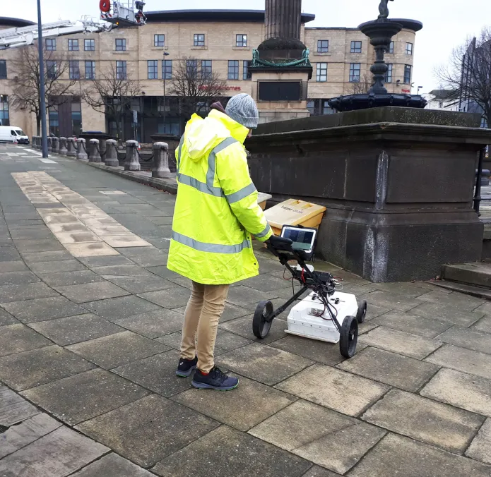
Underground surveying identifies and maps what lies below the surface. It locates the position and depth of utilities, buried obstructions, archaeological features and hazards such as voids and sinkholes. Any of these can have a major effect on a construction project.
The survey produces data that is analysed and interpreted, so you can plan the work before any digging or building starts. Ground penetrating radar (GPR) allows most of this to be done from ground level, without digging into soil or concrete and without damaging floors or surfacing.
How it differs from a surface survey
A surface survey, such as a topographical survey, records what you can see. The surveyor maps natural features like trees, rivers, ponds and rocks, and built features such as buildings, walls, pavements, roads and railway lines. Levels across the site are recorded too.
An underground survey needs specialist equipment, because you cannot see what you are mapping. From the surface, the two main methods are:
- Electromagnetic location (EML), also called radio frequency location. It traces the signals that buried metallic services carry or re-radiate. It only finds metallic objects, or plastic pipes where a sonde or tracer can be used.
- Ground penetrating radar (GPR). It finds objects made of many materials, including metal, plastic, clay, concrete and wood, as well as voids.
Where people can go underground, for example in tunnels or mines, a direct survey can be carried out with conventional instruments such as total stations and GNSS receivers. This needs specialist safety equipment and is a different discipline from the surface-based surveys we carry out.
How GPR works
A GPR system has a transmitter and a receiving antenna. The transmitter sends pulses of radar energy into the ground. When the signal meets a change in material, such as a pipe, a void or a change in soil, part of it reflects back to the receiver. The system records these echoes, and the surveyor builds them into an image or map of the subsurface.
GPR can detect:
- metal and plastic, including PVC
- concrete and clay
- wood
- changes in ground composition
- voids and sinkholes
GPR shows that something is there and how deep it is. It cannot tell you on its own what a service is, which is why we combine it with EML and utility records on utility surveys.
Why underground surveying matters
A clear picture of what is below your site makes a smooth project far more likely.
Utilities. A utility survey tells you where services run, so you can avoid them. A strike costs time and money to repair, and hitting a live electricity cable can be fatal.
Buried obstructions. GPR can locate old foundations, tanks, buried concrete, mine shafts and other features. Finding them early lets you plan around them. If specialist plant is needed to remove an obstruction, you can book it in advance rather than waiting with the site stopped.
Other common targets include archaeological features, reinforcement in concrete, underfloor heating pipes, and voids and sinkholes.
We recommend a survey before any construction work on a building or development site, so you are not caught out by something underground that delays the job and drives up costs.
Benefits of GPR for underground surveys
- Safe to use in public spaces and busy urban areas.
- No digging, so nothing on the surface or below it is damaged.
- Detects metallic and non-metallic objects, voids and changes in the ground.
- Measures the depth and extent of buried features.
- Covers large areas quickly.
- Antenna frequency can be chosen to balance resolution against depth.
- Data can be viewed on site and processed in more detail afterwards.
GPR has limits. Penetration is reduced in wet clay, dense reinforcement can hide what is beneath it, and findings near critical services should be verified before excavation.
Underground surveying equipment
Surveying from the surface without digging uses a small set of instruments, usually together:
- Electromagnetic locators (EML), often called cable locators, trace live cables and metal pipes, and follow a signal put on a service from a chamber or valve. They only detect metal.
- Ground penetrating radar (GPR) detects metallic and non-metallic services, voids, old foundations and changes in the ground. A cart-mounted antenna suits open ground; smaller hand-held antennas are used on concrete and walls.
- Sondes and tracer rods are pushed through drains and ducts so a locator can follow their route from the surface.
- GNSS receivers and total stations position everything that is found, so it can be drawn accurately in CAD.
For a direct survey inside a tunnel or mine, surveyors rely mainly on total stations and laser scanners instead.
Frequently asked questions
How does an underground utility survey help my project?
Knowing where utilities are before work starts helps the project run smoothly. Digging without that information risks damaging services, which increases costs and causes delays.
How long does an underground survey take?
It depends on the type of survey, the size of the area and how easy it is to access. Larger and more congested sites take longer.
Plan your survey
If you are planning excavation or construction, our underground utility survey combines EML and GPR to map buried services before you dig. Contact us to discuss your site.